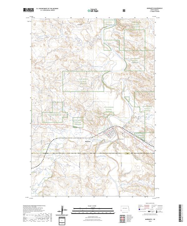
2024 Map of Marmarth
USGS Topo · Published 2024About this map
Marmarth sits at a critical intersection of water and rail transport where the Little Missouri River meets the BNSF Railway. This prairie landscape is defined by the extensive reaches of the Little Missouri National Grassland, punctuated by distinct topographic features like Pretty Butte and the winding course of Little Beaver Creek. The town site itself maintains a traditional grid, featuring streets such as Main St and Railway St that reflect its historical development as a rail hub in the Badlands. On the eastern edge of the settlement, Riverside Cem overlooks the river valley near Dickey Draw. The surrounding territory is marked by tributary drainage systems including South Butte Creek and South Mosquito Creek, alongside modern infrastructure like Oilwell Rd, illustrating the continued importance of land management and resource extraction in this corner of North Dakota.
Find a feature on this map
37 named features on this map. Tap any name to fly to it.
Don’t see what you’re looking for? This feature index may not catch every label — zoom into the map to look around manually.
Map Details
Editions of this 2024 Marmarth Map
This is the sole edition of this map. No revisions or reprints were ever made.
Other maps of this area

1953 · Miles City
USGS Topo · 1:250,000

1953 · Dickinson
USGS Topo · 1:250,000

1957 · Dickinson
USGS Topo · 1:250,000

1957 · Miles City
USGS Topo · 1:250,000

1958 · Miles City
USGS Topo · 1:250,000

1973 · Kid Creek
USGS Topo · 1:24,000

1973 · Cedar Hills
USGS Topo · 1:24,000

1980 · Pretty Butte
USGS Topo · 1:24,000

1980 · Marmarth
USGS Topo · 1:24,000

1980 · Boyce Creek West
USGS Topo · 1:24,000