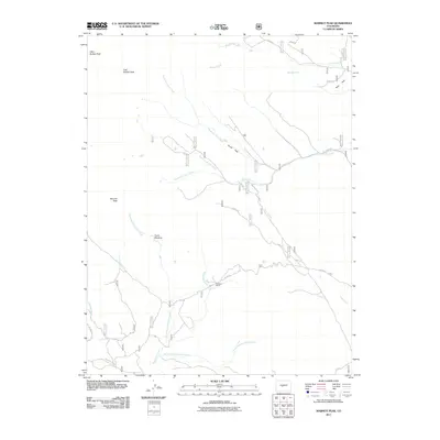
2011 Map of Marmot Peak
USGS Topo · Published 2011About this map
Goddard Ranch sits at a focal point of high-altitude drainage systems in this Chaffee County mountain landscape. The area is defined by a dense network of seasonal and permanent watercourses, including the various forks of Salt Creek and Sevenmile Creek that carve through the local topography. To the north, the twin summits of West Buffalo Peak and East Buffalo Peak dominate the horizon, while Marmot Peak rises to the southwest, framing the high meadows and parks that provided grazing and transit routes for early settlers. A series of forest roads and trails, such as the Lenhardy Cutoff and Trl 311, trace the historical movement across this terrain, connecting open spaces like Davis Meadow and Brush Park. These features reflect a legacy of ranching and land management in the central Colorado Rockies at the start of the twenty-first century.
Find a feature on this map
33 named features on this map. Tap any name to fly to it.
Don’t see what you’re looking for? This feature index may not catch every label — zoom into the map to look around manually.
Map Details
Editions of this 2011 Marmot Peak Map
This is the sole edition of this map. No revisions or reprints were ever made.
Other maps of this area

1889 · Leadville
USGS Topo · 1:125,000

1891 · Leadville
USGS Topo · 1:125,000

1942 · Leadville
USGS Topo · 1:125,000

1953 · Denver
USGS Topo · 1:250,000

1954 · Pueblo
USGS Topo · 1:250,000

1955 · Buena Vista
USGS Topo · 1:62,500

1956 · Garo
USGS Topo · 1:24,000

1956 · Antero Reservoir
USGS Topo · 1:24,000

1956 · Montrose
USGS Topo · 1:250,000

1957 · Denver
USGS Topo · 1:250,000