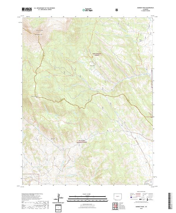
2022 Map of Marmot Peak
USGS Topo · Published 2022About this map
The Buffalo Peaks dominate the northwestern horizon of this high-elevation terrain, where the boundaries of Pike National Forest and San Isabel National Forest meet. This 2022 survey details a complex hydrological landscape defined by the various forks of Salt Cr and Sevenmile Cr. The presence of Brush Park, Pony Park, and Chubb Park suggests the character of these high-altitude basins, which historically served as grazing lands and waypoint markers within the central Colorado mountains. Evidence of early twentieth-century transportation infrastructure persists through modern recreational paths, most notably the Midland Bike Trl, which follows a historic rail grade through the southeastern portion of the map near Chubb Park. Local navigation is defined by a network of established trails, including the Davis Meadow Trl and Mcquaid Trl, connecting landmarks like Marmot Peak and Aspen Arch.
Find a feature on this map
38 named features on this map. Tap any name to fly to it.
Don’t see what you’re looking for? This feature index may not catch every label — zoom into the map to look around manually.
Map Details
Editions of this 2022 Marmot Peak Map
This is the sole edition of this map. No revisions or reprints were ever made.
Other maps of this area

1889 · Leadville
USGS Topo · 1:125,000

1891 · Leadville
USGS Topo · 1:125,000

1942 · Leadville
USGS Topo · 1:125,000

1953 · Denver
USGS Topo · 1:250,000

1954 · Pueblo
USGS Topo · 1:250,000

1955 · Buena Vista
USGS Topo · 1:62,500

1956 · Garo
USGS Topo · 1:24,000

1956 · Antero Reservoir
USGS Topo · 1:24,000

1956 · Montrose
USGS Topo · 1:250,000

1957 · Denver
USGS Topo · 1:250,000