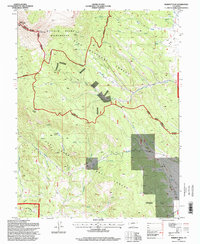
1994 Map of Marmot Peak
USGS Topo · Published 1998About this map
The Continental Divide terrain at the border of Park and Chaffee counties is defined by high alpine summits and intensive resource exploration. High points like West Buffalo Peak and East Buffalo Peak anchor the northern landscape within the Buffalo Peaks Wilderness, while Marmot Peak stands to the south. The drainage patterns of Buffalo Creek, Salt Creek, and several forks of Brush Creek suggest a landscape shaped by significant seasonal runoff, managed in part by an Aqueduct cutting through the San Isabel National Forest. Evidence of historical industry is scattered throughout the slopes, with numerous Mines and Prospect sites located near the Lenhardy Cutoff. These labels reflect the region's long-standing connection to mining and transit through the high passes between the Pike and San Isabel forests.
Find a feature on this map
28 named features on this map. Tap any name to fly to it.
Don’t see what you’re looking for? This feature index may not catch every label — zoom into the map to look around manually.
Map Details
Editions of this 1994 Marmot Peak Map
This is the sole edition of this map. No revisions or reprints were ever made.
Other maps of this area

1889 · Leadville
USGS Topo · 1:125,000

1891 · Leadville
USGS Topo · 1:125,000

1942 · Leadville
USGS Topo · 1:125,000

1953 · Denver
USGS Topo · 1:250,000

1954 · Pueblo
USGS Topo · 1:250,000

1955 · Buena Vista
USGS Topo · 1:62,500

1956 · Garo
USGS Topo · 1:24,000

1956 · Antero Reservoir
USGS Topo · 1:24,000

1956 · Montrose
USGS Topo · 1:250,000

1957 · Denver
USGS Topo · 1:250,000