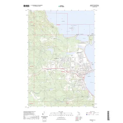
2023 Map of Marquette
USGS Topo · Published 2023About this map
Marquette and its surrounding Upper Peninsula shoreline are documented here in detail, showcasing a landscape where civic infrastructure and education meet the Superior coast. The city center is anchored by the County Courthouse and Northern Michigan University, while the waterfront is defined by Lighthouse Point and the prominent peninsula of Presque Isle. Inland, the terrain rises toward Sugarloaf Mountain and Hogback Mountain, with the Dead River and its series of falls, including Dead River Falls and Reany Falls, carving through the northwestern forests.
Find a feature on this map
89 named features on this map. Tap any name to fly to it.
Don’t see what you’re looking for? This feature index may not catch every label — zoom into the map to look around manually.
Map Details
Editions of this 2023 Marquette Map
This is the sole edition of this map. No revisions or reprints were ever made.
Other maps of this area

1907 · Marquette
USGS Topo · 1:62,500

1932 · Harvey NW
USGS Topo · 1:31,680

1932 · Harvey NE
USGS Topo · 1:31,680

1952 · Sands
USGS Topo · 1:24,000

1952 · Ishpeming
USGS Topo · 1:62,500

1952 · Gwinn
USGS Topo · 1:62,500

1952 · Palmer
USGS Topo · 1:24,000

1953 · Marquette NW
USGS Topo · 1:24,000

1953 · Negaunee
USGS Topo · 1:24,000
1954 · Marquette
USGS Topo · 1:24,000