
1953 Map of Negaunee
USGS Topo · Published 1955About this map
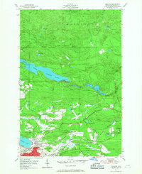
Mining operations and industrial infrastructure dominate the landscape of the central Upper Peninsula during the early 1950s. The city of Negaunee is anchored by significant iron ore extraction sites, including the Mather Mine B, Maas Mine, and Negaunee Mine, illustrating the intense mineral production of the Marquette Iron Range. Transportation networks support this industry, with the Lake Superior and Ishpeming and the Duluth South Shore and Atlantic railroads crisscrossing the terrain. To the north, the Dead River Storage Basin and McClure Storage Basin reflect the region's managed water resources for power and industry. Cultural and civic life is represented by the Marquette County Airport, the Morgan Heights Sanatorium, and local education at Kivela Sch, providing a detailed look at a community built on the wealth of the earth.
Find a feature on this map
35 named features on this map. Tap any name to fly to it.
Don’t see what you’re looking for? This feature index may not catch every label — zoom into the map to look around manually.
Map Details
Editions of this 1953 Negaunee Map
4 editions found
Other maps of this area

1907 · Marquette
USGS Topo · 1:62,500

1932 · Harvey NW
USGS Topo · 1:31,680

1952 · Sands
USGS Topo · 1:24,000

1952 · Ishpeming
USGS Topo · 1:62,500

1952 · Ishpeming
USGS Topo · 1:24,000

1952 · Gwinn
USGS Topo · 1:62,500

1952 · Palmer
USGS Topo · 1:24,000

1953 · Marquette NW
USGS Topo · 1:24,000

1954 · Negaunee SW
USGS Topo · 1:24,000
1954 · Marquette
USGS Topo · 1:24,000
Featured Places
- Negaunee, MI
- Negaunee Township, MI
- Marquette Township, MI
- Ishpeming Township, MI
- Beverly Hills, Negaunee