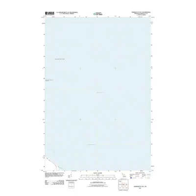
2011 Map of Marquette OE E
USGS Topo · Published 2011About this map
Lake Superior dominates this nautical landscape, capturing the cold waters north of the Upper Peninsula just after the turn of the twenty-first century. The map is largely a hydrographic study of Marquette Bay, focusing on the maritime approaches to the region. A critical navigational landmark, the Presque Isle Breakwater Lighthouse stands at the edge of the harbor works, warning vessels of the nearby Presque Isle Point Rocks. On the small sliver of land visible in the southwest corner, the local street grid begins with Bayou St. This survey reflects the enduring importance of maritime safety and commercial shipping in the Great Lakes, documenting the literal edge where the Michigan shoreline meets the deep water of the largest lake in the world.
Find a feature on this map
5 named features on this map. Tap any name to fly to it.
Don’t see what you’re looking for? This feature index may not catch every label — zoom into the map to look around manually.
Map Details
Editions of this 2011 Marquette OE E Map
This is the sole edition of this map. No revisions or reprints were ever made.
Other maps of this area

1907 · Marquette
USGS Topo · 1:62,500

1932 · Harvey NW
USGS Topo · 1:31,680

1932 · Harvey NE
USGS Topo · 1:31,680

1950 · Skandia NW
USGS Topo · 1:31,680

1952 · Sands
USGS Topo · 1:24,000

1952 · Gwinn
USGS Topo · 1:62,500

1953 · Marquette NW
USGS Topo · 1:24,000
1954 · Marquette
USGS Topo · 1:24,000

1954 · Marquette
USGS Topo · 1:62,500

1958 · Skandia
USGS Topo · 1:62,500