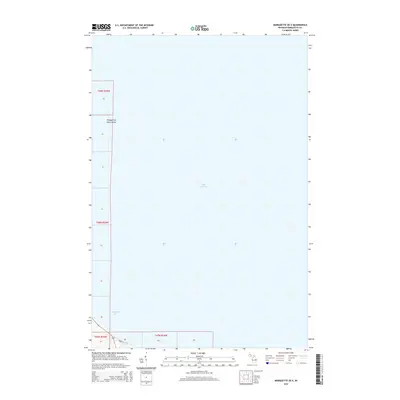
2014 Map of Marquette OE E
USGS Topo · Published 2014About this map
Lake Superior dominates this coastal survey, covering the vast majority of the quadrangle as it stretches north and east from the Upper Peninsula shoreline. The map focuses on the maritime approach to the region, highlighting the transition from the open waters of the lake to the sheltered Marquette Bay. Along the rocky northwestern coastline, Presque Isle Point Rocks serves as a prominent natural landmark for those navigating the waters near the city. On land, the southern edge of the sheet shows a small portion of the local infrastructure, including Bayou St, providing a brief look at the street-level geography just as the terrain meets the water. This 2014 edition captures the modern hydrography and coastline before it gives way to the deep expanse of the Great Lakes.
Find a feature on this map
17 named features on this map. Tap any name to fly to it.
Don’t see what you’re looking for? This feature index may not catch every label — zoom into the map to look around manually.
Map Details
Editions of this 2014 Marquette OE E Map
This is the sole edition of this map. No revisions or reprints were ever made.
Other maps of this area

1907 · Marquette
USGS Topo · 1:62,500

1932 · Harvey NW
USGS Topo · 1:31,680

1932 · Harvey NE
USGS Topo · 1:31,680

1950 · Skandia NW
USGS Topo · 1:31,680

1952 · Sands
USGS Topo · 1:24,000

1952 · Gwinn
USGS Topo · 1:62,500

1953 · Marquette NW
USGS Topo · 1:24,000
1954 · Marquette
USGS Topo · 1:24,000

1954 · Marquette
USGS Topo · 1:62,500

1958 · Skandia
USGS Topo · 1:62,500