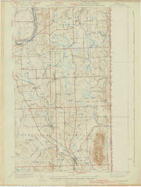
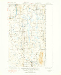
1940 Map of Mars Hill
USGS Topo · Published 1940About this map
Mars Hill dominates the southeastern corner of this Aroostook County landscape, providing a dramatic vertical contrast to the sprawling agricultural and riverine terrain of the Aroostook River valley. The map documents an era of intense cross-border and regional connectivity, characterized by the parallel tracks of the Bangor and Aroostook Railroad and the Canadian Pacific Railroad. These rail lines served as the lifeblood for established towns like Easton, Westfield, and Mars Hill, as well as industrial points like Monson Mill.
Find a feature on this map
80 named features on this map. Tap any name to fly to it.
Don’t see what you’re looking for? This feature index may not catch every label — zoom into the map to look around manually.
Map Details
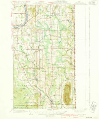
Editions of this 1940 Mars Hill Map
Other maps of this area

1929 · Caribou
USGS Topo · 1:48,000

1930 · Fort Fairfield
USGS Topo · 1:48,000

1932 · Caribou
USGS Topo · 1:62,500

1933 · Fort Fairfield
USGS Topo · 1:62,500

1934 · Bridgewater
USGS Topo · 1:48,000

1935 · Howe Brook
USGS Topo · 1:48,000

1935 · Presque Isle
USGS Topo · 1:62,500

1936 · Mars Hill
USGS Topo · 1:48,000

1938 · Bridgewater
USGS Topo · 1:62,500

1939 · Howe Brook
USGS Topo · 1:62,500