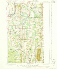
1940 Map of Mars Hill
USGS Topo · Published 1940About this map
The Aroostook River and the Bangor and Aroostook railroad network dominate this 1940 portrait of eastern Aroostook County. The landscape is heavily marked by small-scale agrarian infrastructure, particularly a dense concentration of neighborhood schoolhouses such as Reach Sch, Maple Grove Sch, and Ladner Sch. This educational network suggests a period of robust rural population before the mid-century consolidation of school districts.
Find a feature on this map
94 named features on this map. Tap any name to fly to it.
Don’t see what you’re looking for? This feature index may not catch every label — zoom into the map to look around manually.
Map Details
Editions of this 1940 Mars Hill Map

Other maps of this area

1929 · Caribou
USGS Topo · 1:48,000

1930 · Fort Fairfield
USGS Topo · 1:48,000

1932 · Caribou
USGS Topo · 1:62,500

1933 · Fort Fairfield
USGS Topo · 1:62,500

1934 · Bridgewater
USGS Topo · 1:48,000

1935 · Howe Brook
USGS Topo · 1:48,000

1935 · Presque Isle
USGS Topo · 1:62,500

1936 · Mars Hill
USGS Topo · 1:48,000

1938 · Bridgewater
USGS Topo · 1:62,500

1939 · Howe Brook
USGS Topo · 1:62,500