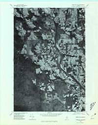
1975 Map of Mars Hill SW
USGS Topo · Published 1981About this map
Westfield serves as the central settlement on this orthophotoquad, situated in a landscape where agricultural clearing meets dense Maine woodland. The imagery, captured by the Geological Survey in the mid-1970s, reveals a distinct pattern of long, narrow rectangular fields that follow the undulating terrain of the Aroostook region. This parceling indicates a well-established potato-farming economy where access to water and transport is paramount. The north-south corridor of Prestile Stream carves through the center of the sheet, joined by smaller tributaries like Clark Brook and Rocky Brook. The photo-mosaic format provides an unvarnished view of the rural infrastructure, showing the relationship between isolated farmsteads and the water sources like Bennett Lake in the northeastern corner. This specialized view is particularly useful for researchers tracing land-use changes and the exact footprint of forest cover before late-20th-century shifts in regional agriculture.
Find a feature on this map
5 named features on this map. Tap any name to fly to it.
Don’t see what you’re looking for? This feature index may not catch every label — zoom into the map to look around manually.
Map Details
Editions of this 1975 Mars Hill SW Map
This is the sole edition of this map. No revisions or reprints were ever made.
Other maps of this area

1934 · Bridgewater
USGS Topo · 1:48,000

1935 · Howe Brook
USGS Topo · 1:48,000

1935 · Presque Isle
USGS Topo · 1:62,500

1936 · Mars Hill
USGS Topo · 1:48,000

1938 · Bridgewater
USGS Topo · 1:62,500

1939 · Howe Brook
USGS Topo · 1:62,500

1940 · Mars Hill
USGS Topo · 1:62,500

1951 · Mars Hill
USGS Topo · 1:62,500

1951 · Bridgewater
USGS Topo · 1:62,500

1953 · Bridgewater
USGS Topo · 1:50,000