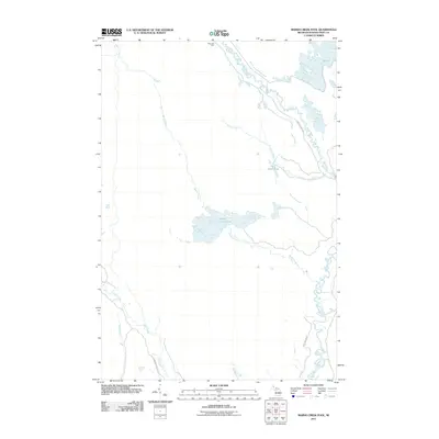
2011 Map of Marsh Creek Pool
USGS Topo · Published 2011About this map
Marsh Creek Pool and the surrounding wetland complex define this segment of Schoolcraft County, where a intricate network of waterways facilitates drainage across the flat landscape. The presence of Riverside Dike and Walsh Ditch indicates active water management within this wilderness area. The hydrologic system is anchored by the meandering Driggs River and Manistique River, which create a series of natural basins including Delta Creek Pool and M Pool. These features suggest a landscape primarily shaped by glacial legacy and modern conservation or resource management efforts. Limited infrastructure, such as the Highwater Truck Trl and Port Inland Rd, provides the only terrestrial access through these low-lying bottomlands, highlighting the area's isolation and its importance as a watershed.
Find a feature on this map
14 named features on this map. Tap any name to fly to it.
Don’t see what you’re looking for? This feature index may not catch every label — zoom into the map to look around manually.
Map Details
Editions of this 2011 Marsh Creek Pool Map
This is the sole edition of this map. No revisions or reprints were ever made.
Other maps of this area

1931 · Seney SW
USGS Topo · 1:31,680

1931 · Manistique River NE
USGS Topo · 1:31,680

1931 · Manistique River SE
USGS Topo · 1:31,680

1931 · Manistique River NW
USGS Topo · 1:31,680

1931 · Blaney SW
USGS Topo · 1:31,680

1931 · Manistique River SW
USGS Topo · 1:31,680

1931 · Driggs Lake SW
USGS Topo · 1:31,680

1931 · Blaney NW
USGS Topo · 1:31,680

1931 · Driggs Lake SE
USGS Topo · 1:31,680

1954 · Sault Sainte Marie
USGS Topo · 1:250,000