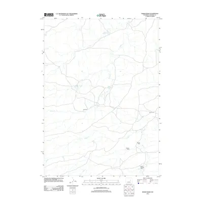
2012 Map of Marsh Draw
USGS Topo · Published 2012About this map
Barton Ranch and Allemand Ranch anchor this Converse County landscape, reflecting the enduring legacy of high-plains ranching operations. The terrain is defined by a network of drainage systems, most notably Marsh Draw, Wallace Draw, and the evocatively named Snake Charmer Draw. Water management in this arid environment is evident through the presence of the Herman Werner Reservoir Number 1 in the northern reach, which captures seasonal flow from Antelope Cr. The map reveals a sparse but deliberate network of local roads and 4WD tracks connecting these isolated homesteads across the drainage basins of Sand Cr and N Sand Cr, illustrating the vast distances and specialized infrastructure required for livestock production in the early 21st century.
Find a feature on this map
9 named features on this map. Tap any name to fly to it.
Don’t see what you’re looking for? This feature index may not catch every label — zoom into the map to look around manually.
Map Details
Editions of this 2012 Marsh Draw Map
This is the sole edition of this map. No revisions or reprints were ever made.
Other maps of this area

1955 · Newcastle
USGS Topo · 1:250,000

1955 · Arminto
USGS Topo · 1:250,000

1958 · Arminto
USGS Topo · 1:250,000

1958 · Newcastle
USGS Topo · 1:250,000

1959 · Fifty-Five Ranch
USGS Topo · 1:62,500

1959 · Edgerton
USGS Topo · 1:62,500

1959 · Ormsby Draw
USGS Topo · 1:62,500

1960 · Ross
USGS Topo · 1:62,500

1962 · Arminto
USGS Topo · 1:250,000

1979 · Bill
USGS Topo · 1:100,000