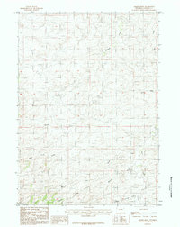
1984 Map of Marsh Draw
USGS Topo · Published 1984About this map
Antelope Creek and its seasonal tributaries define this section of Converse County, as documented in this mid-1980s topographic survey. The landscape is characterized by a series of significant drainage systems, including Marsh Draw, Wallace Draw, and Snake Draw, which carve through the high plains. These dry draws and intermittent watercourses, such as North Sand Creek and Sand Creek, reveal the complex hydrologic patterns of the Wyoming basin where water is a vital but fleeting resource. The mapping captures a network of unimproved roads and trails that connect remote parcels, reflecting the rural ranching and resource-extraction infrastructure of the late 20th century. A lone Spring in the northeastern quadrant and the presence of Bull Gulch further illustrate the localized geography of this sparsely populated interior.
Find a feature on this map
11 named features on this map. Tap any name to fly to it.
Don’t see what you’re looking for? This feature index may not catch every label — zoom into the map to look around manually.
Map Details
Editions of this 1984 Marsh Draw Map
This is the sole edition of this map. No revisions or reprints were ever made.
Other maps of this area

1955 · Newcastle
USGS Topo · 1:250,000

1955 · Arminto
USGS Topo · 1:250,000

1958 · Arminto
USGS Topo · 1:250,000

1958 · Newcastle
USGS Topo · 1:250,000

1959 · Fifty-Five Ranch
USGS Topo · 1:62,500

1959 · Edgerton
USGS Topo · 1:62,500

1959 · Ormsby Draw
USGS Topo · 1:62,500

1960 · Ross
USGS Topo · 1:62,500

1962 · Arminto
USGS Topo · 1:250,000

1979 · Bill
USGS Topo · 1:100,000