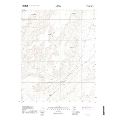
2018 Map of Marsh Pass
USGS Topo · Published 2018About this map
Skeleton Mesa dominates the northern landscape of this region, where deep erosional features like Keet Seel Canyon and Dowozhiebito Canyon carve into the high plateau. The topography is defined by the convergence of these drainage systems near Marsh Pass, a critical geographic gate between the uplands and the lower Long House Valley. Settlement is concentrated at Tsegi, situated at the mouth of Tsegi Canyon where Laguna Creek flows toward the southeast.
Find a feature on this map
19 named features on this map. Tap any name to fly to it.
Don’t see what you’re looking for? This feature index may not catch every label — zoom into the map to look around manually.
Map Details
Editions of this 2018 Marsh Pass Map
This is the sole edition of this map. No revisions or reprints were ever made.
Other maps of this area

1883 · Marsh Pass
USGS Topo · 1:250,000

1892 · Marsh Pass
USGS Topo · 1:250,000

1952 · Agathla Peak 2 SW
USGS Topo · 1:24,000

1952 · Boot Mesa
USGS Topo · 1:62,500

1952 · Agathla Peak 2 SE
USGS Topo · 1:24,000

1956 · Marble Canyon
USGS Topo · 1:250,000

1959 · Marble Canyon
USGS Topo · 1:250,000

1961 · Marble Canyon
USGS Topo · 1:250,000
1968 · Kayenta West
USGS Topo · 1:24,000

1968 · Marsh Pass
USGS Topo · 1:24,000