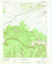
1968 Map of Kayenta West
USGS Topo · Published 1971About this map
Kayenta serves as the primary outpost on this portion of the Navajo Indian Reservation, established near the base of the dramatic Tyende Mesa. The landscape is defined by the winding course of Laguna Creek and its various tributaries, including Parrish Creek and Brent Wash. The high desert terrain is punctuated by vital water sources such as Little Shonto Spring, Fir Spring, and Tees Spa Spring, which were essential for both residents and livestock in this arid environment. Significant cultural and community markers are present, including the local Rodeo Ground and a designated area for Graves near the settlement. The southern half of the map is dominated by the steep escarpments leading to Lolamai Point, where deep drainages like Yellow Water Canyon carve through the plateau, illustrating the complex erosion patterns that characterize this region of Arizona.
Find a feature on this map
15 named features on this map. Tap any name to fly to it.
Don’t see what you’re looking for? This feature index may not catch every label — zoom into the map to look around manually.
Map Details
Editions of this 1968 Kayenta West Map
2 editions found
Other maps of this area

1883 · Marsh Pass
USGS Topo · 1:250,000

1892 · Marsh Pass
USGS Topo · 1:250,000

1952 · Agathla Peak 2 SW
USGS Topo · 1:24,000

1952 · Boot Mesa
USGS Topo · 1:62,500

1952 · Agathla Peak 2 SE
USGS Topo · 1:24,000

1952 · Agathla Peak
USGS Topo · 1:62,500

1952 · Agathla Peak 1 SW
USGS Topo · 1:24,000

1956 · Marble Canyon
USGS Topo · 1:250,000

1959 · Marble Canyon
USGS Topo · 1:250,000

1961 · Marble Canyon
USGS Topo · 1:250,000