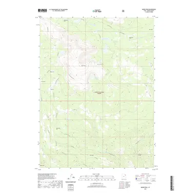
2020 Map of Marsh Peak
USGS Topo · Published 2020About this map
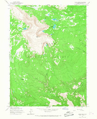
Marsh Peak dominates this high-elevation portion of the Ashley National Forest, serving as a central drainage point for the surrounding glacial basins. The landscape is defined by its extensive water network, including Lakeshore Basin, the Hopper Lakes, and Fish Lake. To the south, human engineering and access are evident through the Dry Fork Flume and the Dry Fork Canyon Rd, which follow the natural contours of the terrain toward lower elevations. The map reveals a high-country economy and recreation system where mountain peaks like Mosby Mtn and deep depressions like Brownie Canyon are linked by primitive routes such as the Ashley Driveway and the more established Red Cloud Loop. Several large meadows or "parks," such as Corral Park and Big Park, suggest historical grazing or camping use within these alpine reaches.
Find a feature on this map
30 named features on this map. Tap any name to fly to it.
Don’t see what you’re looking for? This feature index may not catch every label — zoom into the map to look around manually.
Map Details
Editions of this 2020 Marsh Peak Map
This is the sole edition of this map. No revisions or reprints were ever made.
Other maps of this area

1885 · Ashley
USGS Topo · 1:250,000

1906 · Marsh Peak
USGS Topo · 1:125,000

1908 · Marsh Peak
USGS Topo · 1:125,000

1954 · Vernal
USGS Topo · 1:250,000

1958 · Vernal
USGS Topo · 1:250,000

1960 · Vernal
USGS Topo · 1:250,000
1963 · Whiterocks Lake
USGS Topo · 1:24,000
1963 · Leidy Peak
USGS Topo · 1:24,000
1963 · Elk Park
USGS Topo · 1:24,000
1965 · Marsh Peak
USGS Topo · 1:24,000