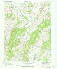
1970 Map of Marshall
USGS Topo · Published 1972About this map
The Southern railroad corridor anchors this Virginia Piedmont landscape, connecting the town of Marshall with The Plains. This early 1970s survey captures a transition in transportation, showing a proposed location for a new highway route cutting through the hills and farmsteads. Significant rural social centers are documented throughout the county, including the Coleman Sch and local congregations at Sago Ch, Little Zion Ch, and Second Mt Morris Ch.
Find a feature on this map
42 named features on this map. Tap any name to fly to it.
Don’t see what you’re looking for? This feature index may not catch every label — zoom into the map to look around manually.
Map Details
Editions of this 1970 Marshall Map
2 editions found
Other maps of this area

1894 · Warrenton
USGS Topo · 1:125,000

1894 · Warrenton
USGS Topo · 1:62,500

1927 · Remington
USGS Topo · 1:48,000

1930 · Warrenton
USGS Topo · 1:62,500

1933 · Middleburg
USGS Topo · 1:62,500

1943 · Catlett
USGS Topo · 1:62,500

1943 · Thorofare Gap
USGS Topo · 1:24,000

1943 · Orlean
USGS Topo · 1:24,000

1943 · Marshall
USGS Topo · 1:24,000

1943 · Upperville
USGS Topo · 1:24,000