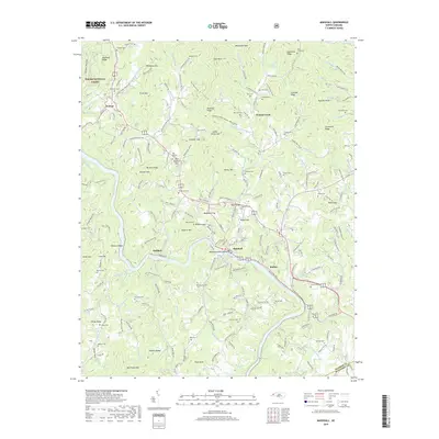
2019 Map of Marshall
USGS Topo · Published 2019About this map
Marshall serves as a focal point along the winding French Broad River, where the town’s core sits adjacent to Blennerhassett Island. This Madison County landscape is defined by its deep ridges and gaps, with the western edge of the quadrangle protected by the Pisgah National Forest. The map documents a scattered settlement pattern through smaller communities like Walnut, Redmon, and Rollins, which are connected by a network of local roads that follow the river valley and narrow mountain gaps. Local genealogy is well-preserved through numerous family burial sites, including the McDevitt Cem, Henderson Cem, and Tillery Cem. High elevations are marked by distinctive peaks such as Barnard Knob and Sevenmile Ridge, framing the corridor of the French Broad as it makes its sharp northwesterly turn toward the Tennessee border.
Find a feature on this map
208 named features on this map. Tap any name to fly to it.
Don’t see what you’re looking for? This feature index may not catch every label — zoom into the map to look around manually.
Map Details
Editions of this 2019 Marshall Map
This is the sole edition of this map. No revisions or reprints were ever made.
Other maps of this area

1894 · Asheville
USGS Topo · 1:125,000

1901 · Asheville
USGS Topo · 1:125,000

1935 · Hot Springs
USGS Topo · 1:24,000

1935 · Spring Creek
USGS Topo · 1:24,000

1936 · Marshall
USGS Topo · 1:24,000

1936 · Sandymush
USGS Topo · 1:24,000

1936 · Sams Gap
USGS Topo · 1:24,000

1936 · White Rock
USGS Topo · 1:24,000

1936 · Weaverville
USGS Topo · 1:24,000

1936 · Mars Hill
USGS Topo · 1:24,000