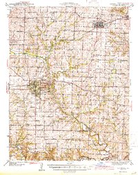
1944 Map of Marshall
USGS Topo · Published 1944About this map
Missouri Valley College serves as a central landmark in this 1940s survey of Saline County, where the city of Marshall functions as a hub for both the Missouri Pacific and Alton railroads. The landscape is defined by the winding course of the Salt Fork Missouri River, which creates a complex drainage system fed by Cow Creek and Rock Creek. Numerous small rural schools like Sunny Side Sch and Robert Leigh Sch illustrate the era's decentralized educational structure before mid-century consolidation.
Find a feature on this map
88 named features on this map. Tap any name to fly to it.
Don’t see what you’re looking for? This feature index may not catch every label — zoom into the map to look around manually.
Map Details
Editions of this 1944 Marshall Map
2 editions found

Other maps of this area

1887 · Sedalia
USGS Topo · 1:125,000

1888 · Boonville
USGS Topo · 1:125,000

1890 · Glasgow
USGS Topo · 1:125,000

1890 · Marshall
USGS Topo · 1:125,000

1892 · Marshall
USGS Topo · 1:125,000

1894 · Sedalia
USGS Topo · 1:125,000

1901 · Marshall
USGS Topo · 1:125,000

1939 · Sweet Springs
USGS Topo · 1:62,500

1940 · Sweet Springs
USGS Topo · 1:62,500

1940 · Marshall
USGS Topo · 1:62,500