
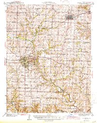
1944 Map of Marshall
USGS Topo · Published 1944About this map
Marshall serves as the hub of Saline County in this mid-century portrait, characterized by a dense network of rural schools and the intersection of the Alton Pacific Railroad and Missouri Pacific Railroad. The town is well-defined, showing the campus of Missouri Valley College, the grounds of Ridge Park, and the city's early Landing Field. Surrounding the municipal center, the landscape is divided into a geometric grid of country roads and farms, punctuated by small community centers like Slater, Gilliam, and Napton.
Find a feature on this map
68 named features on this map. Tap any name to fly to it.
Don’t see what you’re looking for? This feature index may not catch every label — zoom into the map to look around manually.
Map Details
Editions of this 1944 Marshall Map
2 editions found
Other maps of this area

1887 · Sedalia
USGS Topo · 1:125,000

1888 · Boonville
USGS Topo · 1:125,000

1890 · Glasgow
USGS Topo · 1:125,000

1890 · Marshall
USGS Topo · 1:125,000

1892 · Marshall
USGS Topo · 1:125,000

1894 · Sedalia
USGS Topo · 1:125,000

1901 · Marshall
USGS Topo · 1:125,000

1939 · Sweet Springs
USGS Topo · 1:62,500

1940 · Sweet Springs
USGS Topo · 1:62,500

1940 · Marshall
USGS Topo · 1:62,500