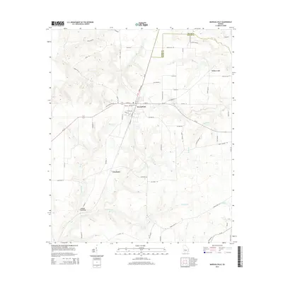
2014 Map of Marshallville
USGS Topo · Published 2014About this map
Marshallville serves as the primary hub in this Georgia landscape, situated near the boundary between Peach and Macon Counties. The town's grid reflects its historical development, with streets like Cotton Ave and Railroad St suggesting its agricultural and transit roots. To the south, the smaller settlements of Winchester and Lowes Crossing are positioned along the winding paths of Spring Hill Cr and Beaver Cr, marking more rural pockets of the county. The terrain is defined by a dense network of tributaries, including Saint Paul Br and Slow Run Cr, which feed into the larger basins of the region. Notable landmarks such as the Marshallville Cemetery and the waters of Willow Lake provide specific points of interest for genealogists and local historians tracing family lineages in this part of the state. Industrial and agricultural markers like Juice Plant Rd further indicate the local economic activity centered around the area's orchards and fields.
Find a feature on this map
50 named features on this map. Tap any name to fly to it.
Don’t see what you’re looking for? This feature index may not catch every label — zoom into the map to look around manually.
Map Details
Editions of this 2014 Marshallville Map
This is the sole edition of this map. No revisions or reprints were ever made.
Other maps of this area

1955 · Phenix City
USGS Topo · 1:250,000

1956 · Fort Valley
USGS Topo · 1:62,500

1957 · Phenix City
USGS Topo · 1:250,000

1957 · Macon
USGS Topo · 1:250,000

1958 · Macon
USGS Topo · 1:250,000

1958 · Phenix City
USGS Topo · 1:250,000

1964 · Macon
USGS Topo · 1:250,000

1971 · Reynolds
USGS Topo · 1:24,000

1971 · Garden Valley
USGS Topo · 1:24,000

1971 · Montezuma
USGS Topo · 1:24,000