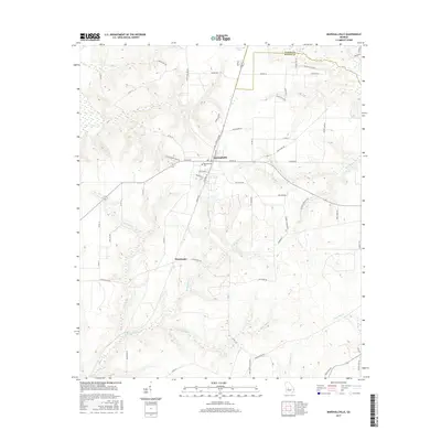
2017 Map of Marshallville
USGS Topo · Published 2017About this map
Marshallville serves as the central hub of this agricultural landscape in southwestern Georgia, situated near the boundary where Peach County meets Macon County. The town's grid reflects a deep-rooted connection to the land and industry, with roads like Cotton Ave and Railroad St hinting at its historical role in the region's transport and trade. To the south, the smaller settlement of Winchester is defined by a network of creeks and branches, including Beaver Creek and Spring Hill Creek, which drain the undulating terrain toward Bryants Swamp.
Find a feature on this map
65 named features on this map. Tap any name to fly to it.
Don’t see what you’re looking for? This feature index may not catch every label — zoom into the map to look around manually.
Map Details
Editions of this 2017 Marshallville Map
This is the sole edition of this map. No revisions or reprints were ever made.
Other maps of this area

1955 · Phenix City
USGS Topo · 1:250,000

1956 · Fort Valley
USGS Topo · 1:62,500

1957 · Phenix City
USGS Topo · 1:250,000

1957 · Macon
USGS Topo · 1:250,000

1958 · Macon
USGS Topo · 1:250,000

1958 · Phenix City
USGS Topo · 1:250,000

1964 · Macon
USGS Topo · 1:250,000

1971 · Reynolds
USGS Topo · 1:24,000

1971 · Garden Valley
USGS Topo · 1:24,000

1971 · Montezuma
USGS Topo · 1:24,000