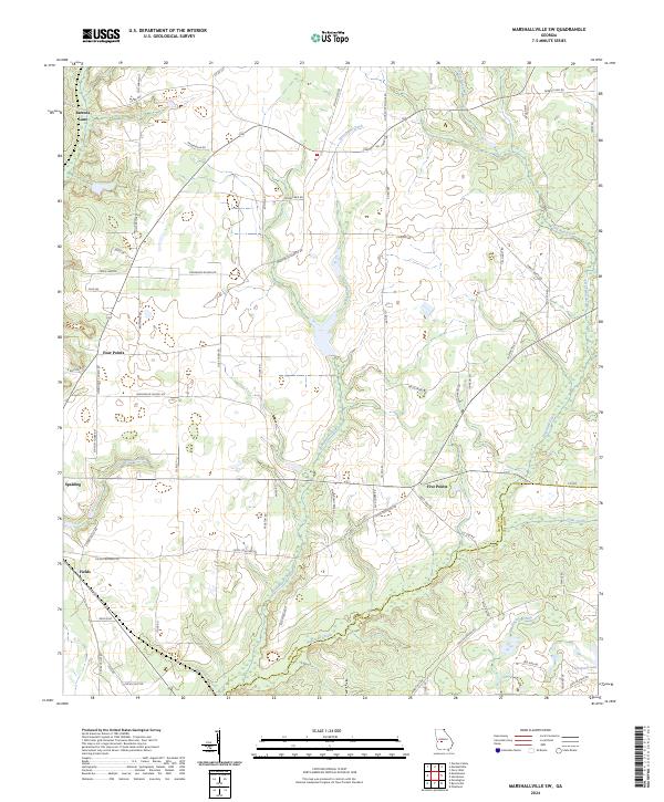
2024 Map of Marshallville SW
USGS Topo · Published 2024About this map
The agricultural landscape of central Georgia is defined here by the winding drainages of Horsehead Creek and Hogcrawl Creek, where the border of Macon Co and Dooly Co follows the local topography. This region is marked by small rural settlements such as Spalding and Fields, which sit along the road network connecting the area's many farms and homesteads. The map illustrates a community shaped by its institutions, with Mennonite Church Rd and Mennonite School Rd indicating the presence of local cultural enclaves.
Find a feature on this map
68 named features on this map. Tap any name to fly to it.
Don’t see what you’re looking for? This feature index may not catch every label — zoom into the map to look around manually.
Map Details
Editions of this 2024 Marshallville SW Map
This is the sole edition of this map. No revisions or reprints were ever made.
Other maps of this area

1955 · Phenix City
USGS Topo · 1:250,000

1957 · Phenix City
USGS Topo · 1:250,000

1957 · Macon
USGS Topo · 1:250,000

1958 · Macon
USGS Topo · 1:250,000

1958 · Phenix City
USGS Topo · 1:250,000

1964 · Macon
USGS Topo · 1:250,000

1971 · Garden Valley
USGS Topo · 1:24,000

1971 · Montezuma
USGS Topo · 1:24,000

1971 · Henderson
USGS Topo · 1:24,000

1971 · Pinehurst
USGS Topo · 1:24,000