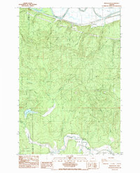
1985 Map of Marshland
USGS Topo · Published 1985About this map
Westport Slough and the winding Nehalem River anchor this mid-1980s study of the timbered borderlands between Clatsop and Columbia counties. The map captures a landscape defined by intensive forestry and industrial transit, evidenced by the presence of the Burlington Northern railroad and extensive private logging routes like the Fibre Mainline. Small communities and camps, including Woodson, Marshland, and Horseshoe Camp, are situated among the ridges and drainages that feed into the Columbia River system.
Find a feature on this map
46 named features on this map. Tap any name to fly to it.
Don’t see what you’re looking for? This feature index may not catch every label — zoom into the map to look around manually.
Map Details
Editions of this 1985 Marshland Map
This is the sole edition of this map. No revisions or reprints were ever made.
Other maps of this area

1919 · Mayger
USGS Topo · 1:62,500

1940 · Vernonia
USGS Topo · 1:62,500

1941 · Keasey
USGS Topo · 1:62,500

1941 · Clatskanie
USGS Topo · 1:62,500

1941 · Cathlamet
USGS Topo · 1:62,500

1943 · Vernonia
USGS Topo · 1:62,500

1943 · Keasey
USGS Topo · 1:62,500

1948 · Vancouver
USGS Topo · 1:250,000

1950 · Vancouver
USGS Topo · 1:250,000

1950 · Vancouver
USGS Topo · 1:250,000