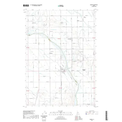
2020 Map of Marsing
USGS Topo · Published 2020About this map
The Snake River winds through the heart of this landscape, marking the boundary between Canyon and Owyhee counties. The town of Marsing serves as a central hub, situated where the river meets a complex network of agricultural infrastructure. This irrigation system is remarkably dense, featuring an intricate web of canals and drains including the Deer Flat Low Line Canal, Mora Canal, and the Lizard Wasteway. These waterworks facilitate the intensive farming seen across the flats, supporting settlements like Claytonia and Knowlton Heights.
Find a feature on this map
92 named features on this map. Tap any name to fly to it.
Don’t see what you’re looking for? This feature index may not catch every label — zoom into the map to look around manually.
Map Details
Editions of this 2020 Marsing Map
This is the sole edition of this map. No revisions or reprints were ever made.
Other maps of this area

1892 · Silver City
USGS Topo · 1:125,000

1894 · Silver City
USGS Topo · 1:125,000

1898 · Nampa
USGS Topo · 1:125,000

1898 · Silver City
USGS Topo · 1:125,000

1955 · Boise
USGS Topo · 1:250,000

1957 · Opalene Gulch
USGS Topo · 1:24,000

1957 · Wilder
USGS Topo · 1:24,000

1957 · Sands Basin
USGS Topo · 1:62,500

1957 · Notus
USGS Topo · 1:24,000

1958 · Boise
USGS Topo · 1:250,000