2023 Map of Marsing
USGS Topo · Published 2023About this map
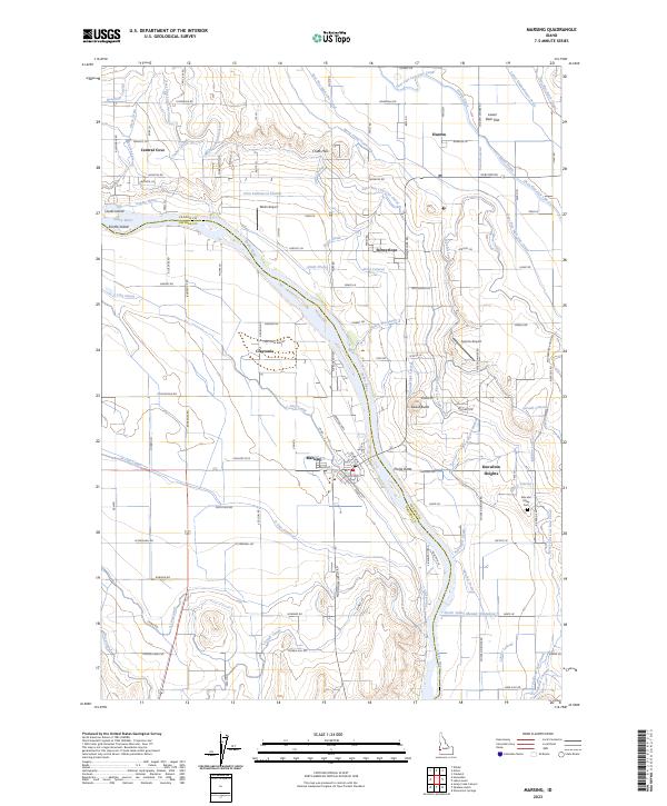
The Snake River carves a winding path through this corner of the Treasure Valley, serving as the boundary between Canyon and Owyhee counties. The town of Marsing anchors the southern landscape, while a dense network of irrigation infrastructure, including the Deer Flat High Line Canal and Mora Canal Extension, transformed these arid plains into a productive agricultural district. Significant portions of the riverfront and surrounding wetlands are protected within the Deer Flat National Wildlife Refuge, which spans both sides of the river and encompasses river islands like Clarks Island. Distinctive volcanic landmarks such as Lizard Butte and Pickle Butte rise above the basin, providing geological markers for the rural communities of Sunnyslope and Claytonia. Local history is preserved at the Peaceful Valley Cem, located near the eastern foothills of Knowlton Heights.
Find a feature on this map
132 named features on this map. Tap any name to fly to it.
Don’t see what you’re looking for? This feature index may not catch every label — zoom into the map to look around manually.
Map Details
Editions of this 2023 Marsing Map
This is the sole edition of this map. No revisions or reprints were ever made.