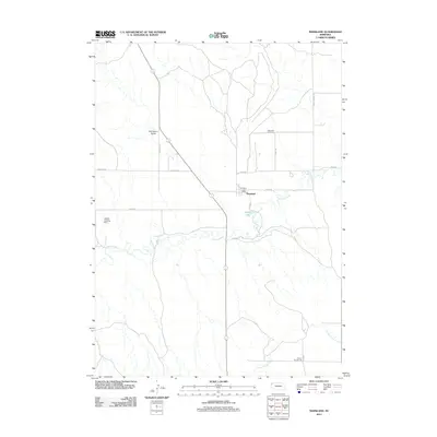
2011 Map of Marsland
USGS Topo · Published 2011About this map
Marsland anchors this high plains landscape in Dawes County, where the settlement is defined by its position along the meandering Niobrara River. This 2011 survey illustrates a sparse ranching and agricultural region where civic life is marked by the Marsland Post Office and the Marsland Cemetery, which serves the surrounding community. The presence of School Number 76 to the southeast indicates the persistence of rural school districts in this corner of Nebraska.
Find a feature on this map
17 named features on this map. Tap any name to fly to it.
Don’t see what you’re looking for? This feature index may not catch every label — zoom into the map to look around manually.
Map Details
Editions of this 2011 Marsland Map
This is the sole edition of this map. No revisions or reprints were ever made.
Other maps of this area

1946 · Nonpareil
USGS Topo · 1:24,000

1946 · Box Butte Reservoir West
USGS Topo · 1:24,000

1948 · Box Butte Reservoir West
USGS Topo · 1:24,000

1948 · Nonpareil
USGS Topo · 1:24,000

1951 · Marsland
USGS Topo · 1:62,500

1955 · Alliance
USGS Topo · 1:250,000

1957 · Alliance
USGS Topo · 1:250,000

1958 · Alliance
USGS Topo · 1:250,000
1980 · Coffee Mill Butte SW
USGS Topo · 1:24,000

1980 · Dead Mans Creek
USGS Topo · 1:24,000