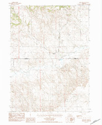
1983 Map of Marsland
USGS Topo · Published 1984About this map
Marsland sits at a geographic crossroads in the Nebraska Panhandle, where the Burlington Northern railroad corridor meets the winding course of the Niobrara River. This 1980s landscape transition is marked by the sharp boundary between Dawes and Box Butte counties, cutting across a terrain of high plains and dramatic incisions like Sand Canyon. The presence of the Marsland Cem and the Wilkins Landing Strip suggests a community balancing its pioneer roots with modern rural aviation needs. To the south, the watershed is defined by Dry Creek, while the river valley itself provides a focal point for local resources, evidenced by the Gregg Lake catchment and scattered industrial sites like the Gravel Pit. The map captures the specialized topography of Shevation Gulch, illustrating the erosional patterns typical of this semi-arid high country.
Find a feature on this map
11 named features on this map. Tap any name to fly to it.
Don’t see what you’re looking for? This feature index may not catch every label — zoom into the map to look around manually.
Map Details
Editions of this 1983 Marsland Map
This is the sole edition of this map. No revisions or reprints were ever made.
Other maps of this area

1946 · Nonpareil
USGS Topo · 1:24,000

1946 · Box Butte Reservoir West
USGS Topo · 1:24,000

1948 · Box Butte Reservoir West
USGS Topo · 1:24,000

1948 · Nonpareil
USGS Topo · 1:24,000

1951 · Marsland
USGS Topo · 1:62,500

1955 · Alliance
USGS Topo · 1:250,000

1957 · Alliance
USGS Topo · 1:250,000

1958 · Alliance
USGS Topo · 1:250,000
1980 · Coffee Mill Butte SW
USGS Topo · 1:24,000

1980 · Dead Mans Creek
USGS Topo · 1:24,000