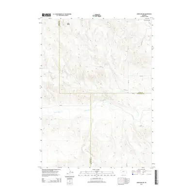
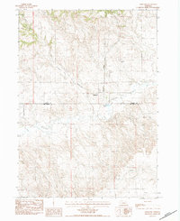
2014 Map of Marsland NW
USGS Topo · Published 2014About this map
Pine Ridge dominates the northern landscape of this High Plains quadrangle, where the terrain breaks into a series of steep drainages and escarpments. The Niobrara River flows across the southern portion of the sheet, serving as a primary hydrological feature in this rural corner of Nebraska. This 2014 survey documents the intersections of Dawes, Sioux, and Box Butte counties, a region defined by large-scale ranching and sparse residential development. Local transit is facilitated by a network of rural routes including Diehl Rd and River Rd, which follow the natural contours of the land. Waterways like Barngrover Cr and the evocatively named Starvation Gulch carve through the sedimentary layers of the ridge, illustrating the erosional patterns typical of the Nebraska Panhandle’s unique geology.
Find a feature on this map
13 named features on this map. Tap any name to fly to it.
Don’t see what you’re looking for? This feature index may not catch every label — zoom into the map to look around manually.
Map Details
Editions of this 2014 Marsland NW Map
This is the sole edition of this map. No revisions or reprints were ever made.
Other maps of this area

1899 · Whistle Creek
USGS Topo · 1:125,000

1951 · Marsland
USGS Topo · 1:62,500

1955 · Alliance
USGS Topo · 1:250,000

1957 · Alliance
USGS Topo · 1:250,000

1958 · Alliance
USGS Topo · 1:250,000

1980 · Dead Mans Creek
USGS Topo · 1:24,000
1980 · Belmont
USGS Topo · 1:24,000
1980 · Glen
USGS Topo · 1:24,000
1983 · Marsland SE
USGS Topo · 1:24,000
1983 · Marsland
USGS Topo · 1:24,000