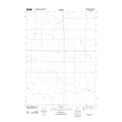
2011 Map of Marsland SE
USGS Topo · Published 2011About this map
The High Plains of Box Butte County are defined here by the intricate drainage systems of Sand Canyon Creek and Point of Rocks Creek. This 2011 survey reveals a landscape organized by a rigid section line road grid, with Cass Rd and Hall Rd bounding a territory largely dedicated to ranching and dryland farming. Small-scale water management is evident through the placement of Henrich Dam and Nikont Dam, which provide vital catchments in this arid environment. Near the center of the quadrangle, Lawn Cemetery stands as a quiet focal point of local heritage, while the various forks of the local waterways, including the North Branch Point of Rocks Creek and South Branch Point of Rocks Creek, reveal the natural erosion patterns across the Nebraska panhandle. The map captures the enduring rural character of the region, where family names are often reflected in the infrastructure of the dams and throughfares.
Find a feature on this map
16 named features on this map. Tap any name to fly to it.
Don’t see what you’re looking for? This feature index may not catch every label — zoom into the map to look around manually.
Map Details
Editions of this 2011 Marsland SE Map
This is the sole edition of this map. No revisions or reprints were ever made.
Other maps of this area

1946 · Nonpareil
USGS Topo · 1:24,000

1946 · Box Butte Reservoir West
USGS Topo · 1:24,000

1948 · Box Butte Reservoir West
USGS Topo · 1:24,000

1948 · Hemingford 4 NW
USGS Topo · 1:24,000

1948 · Nonpareil
USGS Topo · 1:24,000

1951 · Marsland
USGS Topo · 1:62,500

1951 · Kilpatrick Lake
USGS Topo · 1:62,500

1955 · Alliance
USGS Topo · 1:250,000

1957 · Alliance
USGS Topo · 1:250,000

1958 · Alliance
USGS Topo · 1:250,000