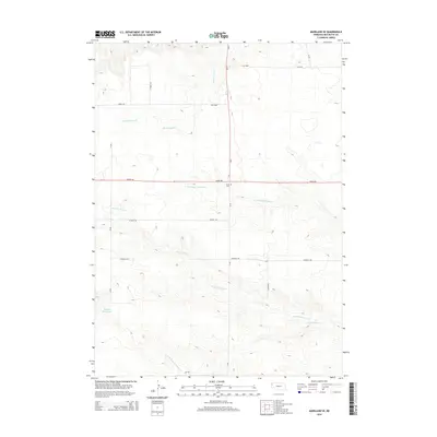
2014 Map of Marsland SE
USGS Topo · Published 2014About this map
Lawn Cem stands along the intersection of Ne-2 and Dodge Rd, marking a quiet cultural landmark in this rural Box Butte County landscape. This section of Nebraska is defined by a dendritic network of seasonal drainages, including the northern, southern, and main branches of Point of Rocks Cr and the upper reaches of Sand Canyon Cr. The map reveals a highly structured agricultural grid, where section lines are traced by local thoroughfares like Cherry Rd, Filmore Rd, and Franklin Rd. Water management is central to the area's geography, evidenced by the presence of the Henrich Reservoir in the southwest and Nikont Reservoir to the southeast. These man-made features alongside the natural creek beds illustrate the intersection of Nebraska's ranching and farming requirements with its prairie hydrology.
Find a feature on this map
22 named features on this map. Tap any name to fly to it.
Don’t see what you’re looking for? This feature index may not catch every label — zoom into the map to look around manually.
Map Details
Editions of this 2014 Marsland SE Map
This is the sole edition of this map. No revisions or reprints were ever made.
Other maps of this area

1946 · Nonpareil
USGS Topo · 1:24,000

1946 · Box Butte Reservoir West
USGS Topo · 1:24,000

1948 · Box Butte Reservoir West
USGS Topo · 1:24,000

1948 · Hemingford 4 NW
USGS Topo · 1:24,000

1948 · Nonpareil
USGS Topo · 1:24,000

1951 · Marsland
USGS Topo · 1:62,500

1951 · Kilpatrick Lake
USGS Topo · 1:62,500

1955 · Alliance
USGS Topo · 1:250,000

1957 · Alliance
USGS Topo · 1:250,000

1958 · Alliance
USGS Topo · 1:250,000