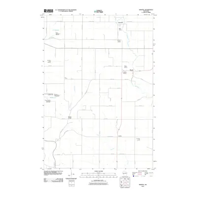
2010 Map of Martell
USGS Topo · Published 2010About this map
The Rush River corridor defines the rural landscape of Pierce County in this 2010 survey, winding southward through a region characterized by small crossroads settlements and agricultural persistence. The village of Martell sits as a central point along the river, flanked by multiple historic burial grounds including the Martell Lutheran Cemetery and Martell Methodist Cemetery. This area reflects the late 19th-century settlement patterns of Wisconsin, where small hubs like Centerville, Clay Corners, and Morton Corner served as the primary social and economic anchors for local farming families.
Find a feature on this map
35 named features on this map. Tap any name to fly to it.
Don’t see what you’re looking for? This feature index may not catch every label — zoom into the map to look around manually.
Map Details
Editions of this 2010 Martell Map
This is the sole edition of this map. No revisions or reprints were ever made.
Other maps of this area

1940 · Maiden Rock
USGS Topo · 1:62,500

1944 · Red Wing
USGS Topo · 1:62,500

1946 · River Falls
USGS Topo · 1:62,500

1949 · River Falls
USGS Topo · 1:62,500

1949 · Baldwin
USGS Topo · 1:62,500

1950 · Maiden Rock
USGS Topo · 1:62,500

1952 · Red Wing
USGS Topo · 1:62,500

1953 · Saint Paul
USGS Topo · 1:250,000

1959 · Saint Paul
USGS Topo · 1:250,000
1974 · River Falls East
USGS Topo · 1:24,000