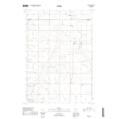
2018 Map of Martell
USGS Topo · Published 2018About this map
The Rush River and its tributaries carve a distinct path through the landscape of northeastern Ellsworth and the surrounding township. This modern survey illustrates the persistent rural character of the region, where small settlements like Martell, Centerville, and Lawton remain anchored by historical community sites. The concentration of heritage locations is particularly evident in the cluster of Martell Lutheran Cem, Martell Methodist Cem, and the Rush River Lutheran Cem, which speak to the area's early denominational roots. The terrain is defined by the drainage patterns of Goose Cr and Lost Cr, while the northern boundary is marked by the St. Croix Co line. For researchers, the map provides a precise layout of the grid-based road network, including numerous numbered avenues like 870th Ave and 720th Ave that connect the dispersed farmsteads and cemeteries.
Find a feature on this map
42 named features on this map. Tap any name to fly to it.
Don’t see what you’re looking for? This feature index may not catch every label — zoom into the map to look around manually.
Map Details
Editions of this 2018 Martell Map
This is the sole edition of this map. No revisions or reprints were ever made.
Other maps of this area

1940 · Maiden Rock
USGS Topo · 1:62,500

1944 · Red Wing
USGS Topo · 1:62,500

1946 · River Falls
USGS Topo · 1:62,500

1949 · River Falls
USGS Topo · 1:62,500

1949 · Baldwin
USGS Topo · 1:62,500

1950 · Maiden Rock
USGS Topo · 1:62,500

1952 · Red Wing
USGS Topo · 1:62,500

1953 · Saint Paul
USGS Topo · 1:250,000

1959 · Saint Paul
USGS Topo · 1:250,000
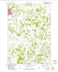
1974 · River Falls East
USGS Topo · 1:24,000