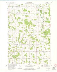
1974 Map of Martell
USGS Topo · Published 1977About this map
The Rush River and Trimbelle River valleys define the landscape of this western Wisconsin survey, which details a rural agricultural region on the border of St. Croix and Pierce Counties. Small crossroads communities and dispersed farmsteads are connected by a network of gravel and improved roads, centered around the settlement of Martell. Local genealogy is well-represented through the presence of several country parishes and burial grounds, including the Rush River Ch, Mt Olivet Cem, and the dual-labeled Our Savior Ch and Our Savior Ch South Rush River.
Find a feature on this map
22 named features on this map. Tap any name to fly to it.
Don’t see what you’re looking for? This feature index may not catch every label — zoom into the map to look around manually.
Map Details
Editions of this 1974 Martell Map
This is the sole edition of this map. No revisions or reprints were ever made.
Other maps of this area

1940 · Maiden Rock
USGS Topo · 1:62,500

1944 · Red Wing
USGS Topo · 1:62,500

1946 · River Falls
USGS Topo · 1:62,500

1949 · River Falls
USGS Topo · 1:62,500

1949 · Baldwin
USGS Topo · 1:62,500

1950 · Maiden Rock
USGS Topo · 1:62,500

1952 · Red Wing
USGS Topo · 1:62,500

1953 · Saint Paul
USGS Topo · 1:250,000

1959 · Saint Paul
USGS Topo · 1:250,000
1974 · River Falls East
USGS Topo · 1:24,000