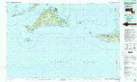
1994 Map of Martha's Vineyard
USGS Topo · Published 1994About this map
The maritime landscapes of Martha's Vineyard and Nantucket Island are shown here following revisions in the early 1990s. The map details the complex coastal geography from the Elizabeth Islands in Buzzards Bay to the eastern shores of Quidnet and Siasconset. This edition illustrates the expansive Manuel F Correllus State Forest at the heart of the Vineyard and the protected lands of the Nantucket Island National Wildlife Refuge and Nomans Land Island National Wildlife Refuge. The settlement patterns of the era are visible in established towns like Vineyard Haven, Oak Bluffs, and Edgartown, contrasted with the seasonal character of Madaket and Wauwinet. Significant transportation infrastructure, including the Martha's Vineyard Airport and the coastal State Road, supports the region's connection to the mainland via Vineyard Sound and Nantucket Sound.
Find a feature on this map
270 named features on this map. Tap any name to fly to it.
Don’t see what you’re looking for? This feature index may not catch every label — zoom into the map to look around manually.
Map Details
Editions of this 1994 Martha's Vineyard Map
This is the sole edition of this map. No revisions or reprints were ever made.
Other maps of this area

1885 · New Bedford
USGS Topo · 1:62,500

1885 · Sakonnet
USGS Topo · 1:62,500

1886 · Falmouth
USGS Topo · 1:62,500

1887 · Gay Head
USGS Topo · 1:62,500

1887 · Muskeget
USGS Topo · 1:62,500

1887 · Marthas Vineyard
USGS Topo · 1:62,500

1887 · Yarmouth
USGS Topo · 1:62,500

1888 · Chatham
USGS Topo · 1:62,500

1888 · New Bedford
USGS Topo · 1:62,500

1888 · Fall River
USGS Topo · 1:62,500