
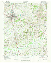
1950 Map of Martin
USGS Topo · Published 1952About this map
The town of Martin serves as a significant educational and transportation hub in Weakley County during the early 1950s. The campus of the University of Tennessee (Martin Branch) and the County Training School anchor the northern settlement, while a dense network of country churches and family cemeteries like Crockett Cem and Old Ames Cem characterize the surrounding agricultural landscape. Two major rail lines, the Illinois Central and the Nashville Chattanooga and St Louis, intersect in the heart of town, illustrating the importance of rail transit for both passengers and the local economy. Beyond the town limits, rural life is organized around small community centers such as Hyndsver and Ralston, while aviation is represented by the Gill Dove Landing Field. The drainage patterns of Cane Creek and Mud Creek define the low-lying areas of the countryside.
Find a feature on this map
37 named features on this map. Tap any name to fly to it.
Don’t see what you’re looking for? This feature index may not catch every label — zoom into the map to look around manually.
Map Details
Editions of this 1950 Martin Map
4 editions found
Other maps of this area

1952 · Dresden
USGS Topo · 1:24,000

1954 · Rutherford
USGS Topo · 1:24,000

1954 · Greenfield
USGS Topo · 1:24,000

1956 · Gardner
USGS Topo · 1:24,000

1956 · Harris
USGS Topo · 1:24,000

1956 · Mc Connell
USGS Topo · 1:24,000

1956 · Latham
USGS Topo · 1:24,000

1956 · Dyersburg
USGS Topo · 1:250,000

1967 · Pillowville
USGS Topo · 1:24,000
1972 · Martin
USGS Topo · 1:62,500