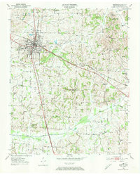
1950 Map of Martin
USGS Topo · Published 1973About this map
The town of Martin serves as the focal point for this mid-century survey of Weakley County, highlighting its role as an educational and transportation hub. The sprawling campus of the University of Tennessee (Martin Branch) and the County Training School represent the local investment in academia, while the intersection of the Illinois Central and the Nashville Chattanooga and St Louis railroads underscores the importance of the rail economy.
Find a feature on this map
44 named features on this map. Tap any name to fly to it.
Don’t see what you’re looking for? This feature index may not catch every label — zoom into the map to look around manually.
Map Details
Editions of this 1950 Martin Map
4 editions found
Other maps of this area

1950 · Martin
USGS Topo · 1:24,000

1952 · Dresden
USGS Topo · 1:24,000

1954 · Rutherford
USGS Topo · 1:24,000

1954 · Greenfield
USGS Topo · 1:24,000

1956 · Gardner
USGS Topo · 1:24,000

1956 · Harris
USGS Topo · 1:24,000

1956 · Mc Connell
USGS Topo · 1:24,000

1956 · Latham
USGS Topo · 1:24,000

1956 · Dyersburg
USGS Topo · 1:250,000

1967 · Pillowville
USGS Topo · 1:24,000