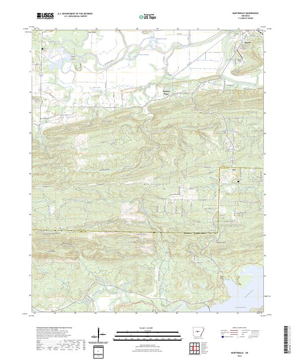
2024 Map of Martindale
USGS Topo · Published 2024About this map
The Fourche LaFave River meanders across the northern portion of this Perry and Pulaski County landscape, defining a wide bottomland filled with wetlands like Turkey Swamp and Winford Brake. To the south, the terrain rises sharply into the ridgelines of Wye Mountain and Holliday Mountain, creating a distinct divide between the river valley and the headwaters of the Maumelle River. Small settlements such as Bigelow and Wye serve as local anchors, connected by a network of rural roads like Co RD 82 and Tram Rd.
Find a feature on this map
86 named features on this map. Tap any name to fly to it.
Don’t see what you’re looking for? This feature index may not catch every label — zoom into the map to look around manually.
Map Details
Editions of this 2024 Martindale Map
This is the sole edition of this map. No revisions or reprints were ever made.
Other maps of this area

1889 · Morrilton No. 3
USGS Topo · 1:62,500

1890 · Benton
USGS Topo · 1:125,000

1892 · Morrillton
USGS Topo · 1:125,000

1894 · Morrillton
USGS Topo · 1:125,000

1894 · Benton
USGS Topo · 1:125,000

1955 · Little Rock
USGS Topo · 1:250,000

1956 · Little Rock
USGS Topo · 1:250,000

1956 · Russellville
USGS Topo · 1:250,000

1960 · Little Rock
USGS Topo · 1:250,000

1961 · Perryville
USGS Topo · 1:24,000