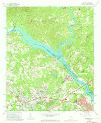
1964 Map of Martinez
USGS Topo · Published 1973About this map
The Savannah River carves a winding path through this 1960s landscape, serving as the primary boundary between Columbia and Richmond Counties in Georgia and Edgefield and Aiken Counties in South Carolina. The area is defined by its transition from the managed timber of the Sumter National Forest in the north to the expanding residential and industrial fringes near Martinez. Key infrastructure along the waterway includes the Augusta City Lock and Dam and a power plant at the Stevens Creek confluence.
Find a feature on this map
81 named features on this map. Tap any name to fly to it.
Don’t see what you’re looking for? This feature index may not catch every label — zoom into the map to look around manually.
Map Details
Editions of this 1964 Martinez Map
4 editions found
Other maps of this area

1892 · Mc Cormick
USGS Topo · 1:125,000

1912 · Mc Cormick
USGS Topo · 1:125,000

1920 · Clarks Hill
USGS Topo · 1:48,000

1921 · Augusta
USGS Topo · 1:62,500

1921 · Clarks Hill
USGS Topo · 1:62,500

1922 · Hephzibah
USGS Topo · 1:62,500

1923 · Warrenville
USGS Topo · 1:48,000

1928 · Warrenville
USGS Topo · 1:62,500

1941 · Clarks Hill
USGS Topo · 1:62,500

1942 · Clarks Hill
USGS Topo · 1:62,500