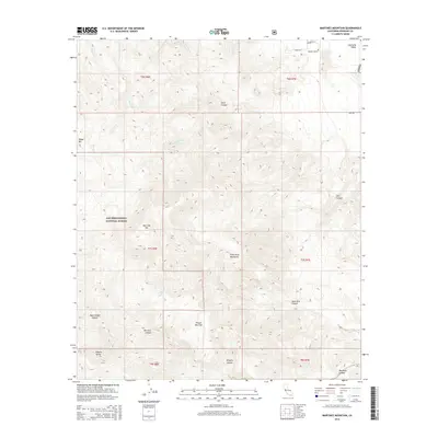
2015 Map of Martinez Mountain
USGS Topo · Published 2015About this map
Martinez Mtn and the Santa Rosa Mountains dominate this high-desert landscape in the southern California interior. The map illustrates a dramatic topographical transition from the agricultural and residential outskirts of the Coachella Valley in the northeast to the protected wilderness of the San Bernardino National Forest. This 2015 survey details a network of canyons, including Devil Canyon, Agua Alta Canyon, and Black Rabbit Canyon, which define the drainage patterns of the range. The presence of Agua Alta Spring and the open expanse of Pinyon Alta Flat suggest the unique ecological and hydrologic features that have shaped human and natural activity in this arid region. On the valley floor, the encroachment of modern development is visible through labels like Quarry Ranch Rd and Fazio Ln S, contrasting with the vast roadless areas of the mountains.
Find a feature on this map
28 named features on this map. Tap any name to fly to it.
Don’t see what you’re looking for? This feature index may not catch every label — zoom into the map to look around manually.
Map Details
Editions of this 2015 Martinez Mountain Map
This is the sole edition of this map. No revisions or reprints were ever made.
Other maps of this area

1904 · Indio
USGS Topo · 1:125,000

1931 · Vallecito
USGS Topo · 1:125,000

1941 · Toro Peak
USGS Topo · 1:62,500

1941 · Clark Lake
USGS Topo · 1:62,500

1941 · Coachella
USGS Topo · 1:62,500

1942 · Agua Dulce
USGS Topo · 1:62,500

1942 · Clark Lake
USGS Topo · 1:62,500

1943 · Vallecito
USGS Topo · 1:125,000

1943 · Coachella
USGS Topo · 1:62,500

1944 · Agua Dulce
USGS Topo · 1:62,500