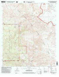
1996 Map of Martinez Mountain
USGS Topo · Published 1999About this map
The Santa Rosa Mountains dominate this 1996 revision, showcasing a landscape defined by significant elevation changes and protected wilderness. Centered on Martinez Mountain and Sheep Mountain, the map illustrates a network of drainage systems like Devil Canyon and Guadalupe Creek that carve through the high desert. The presence of the Coachella Valley Aqueduct in the northeast corner highlights the critical infrastructure required to manage water in this arid environment, contrasted by the remote Agua Alta Spring. High-country paths like the Cactus Spring Trail provide the only access through the Santa Rosa Wilderness, where the terrain drops sharply toward the Casa De Cuerva. This survey reflects the complex management of the San Bernardino National Forest and the State Game Refuge during the late twentieth century.
Find a feature on this map
28 named features on this map. Tap any name to fly to it.
Don’t see what you’re looking for? This feature index may not catch every label — zoom into the map to look around manually.
Map Details
Editions of this 1996 Martinez Mountain Map
This is the sole edition of this map. No revisions or reprints were ever made.
Other maps of this area

1904 · Indio
USGS Topo · 1:125,000

1931 · Vallecito
USGS Topo · 1:125,000

1941 · Toro Peak
USGS Topo · 1:62,500

1941 · Clark Lake
USGS Topo · 1:62,500

1941 · Coachella
USGS Topo · 1:62,500

1942 · Agua Dulce
USGS Topo · 1:62,500

1942 · Clark Lake
USGS Topo · 1:62,500

1943 · Vallecito
USGS Topo · 1:125,000

1943 · Coachella
USGS Topo · 1:62,500

1944 · Agua Dulce
USGS Topo · 1:62,500