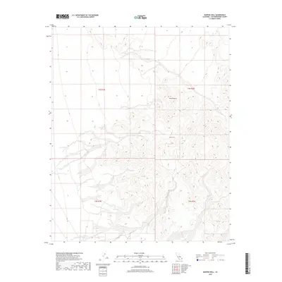
2018 Map of Martins Well
USGS Topo · Published 2018About this map
Mojave Desert terrain defines this arid portion of San Bernardino County, where the landscape is marked primarily by severe topographic relief and seasonal drainage patterns. This 2018 survey illustrates a sparsely developed corner of the desert, where the eponymous Martins Well serves as a critical named water feature in an otherwise dry expanse. The map detail highlights the complex system of ridgelines and desert washes that characterize this region, illustrating the difficult geography that has influenced travel and land use in the eastern California desert. For researchers, the map provides precise documentation of the Public Land Survey System boundaries, including t3n r19e and t3n r20e, which are essential for identifying historical land claims and modern property boundaries in this remote environment.
Find a feature on this map
6 named features on this map. Tap any name to fly to it.
Don’t see what you’re looking for? This feature index may not catch every label — zoom into the map to look around manually.
Map Details
Editions of this 2018 Martins Well Map
This is the sole edition of this map. No revisions or reprints were ever made.
Other maps of this area

1942 · Amboy
USGS Topo · 1:250,000

1943 · Amboy
USGS Topo · 1:250,000

1943 · Turtle Mts.
USGS Topo · 1:62,500

1943 · Iron Mountains
USGS Topo · 1:62,500

1954 · Needles
USGS Topo · 1:250,000

1954 · Turtle Mountains
USGS Topo · 1:62,500

1954 · Rice
USGS Topo · 1:62,500

1956 · Needles
USGS Topo · 1:250,000

1956 · Milligan
USGS Topo · 1:62,500

1956 · Iron Mountains
USGS Topo · 1:62,500