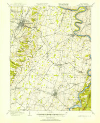
1914 Map of Martinsburg
USGS Topo · Published 1914About this map
Martinsburg and Charles Town serve as the principal hubs of the Eastern Panhandle in this era, connected by a dense network of turnpikes and competing rail lines. The B and O RR and Norfolk and Western RR bisect the limestone valley, meeting at the vital interchange of Shenandoah Junction. Along the Potomac River, the Chesapeake and Ohio Canal hugs the Maryland bank near Terrapin Neck, while the Shenandoah River cuts through the gap near Bolivar. The landscape is dotted with small-scale rural infrastructure, from the County Home near the center of the sheet to numerous neighborhood institutions like the Wiltshire School and Mt Zion Church. Notable historical landmarks include the John Brown Cave near Bakerton, reflecting the region's deep ties to the events surrounding the Harper's Ferry raid.
Find a feature on this map
112 named features on this map. Tap any name to fly to it.
Don’t see what you’re looking for? This feature index may not catch every label — zoom into the map to look around manually.
Map Details
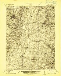
Editions of this 1914 Martinsburg Map
3 editions found

Other maps of this area

1884 · Harpers Ferry
USGS Topo · 1:125,000

1891 · Harpers Ferry
USGS Topo · 1:125,000

1893 · Harpers Ferry
USGS Topo · 1:125,000

1894 · Winchester
USGS Topo · 1:125,000

1899 · Hancock
USGS Topo · 1:62,500

1901 · Hancock
USGS Topo · 1:62,500

1908 · Middletown
USGS Topo · 1:48,000

1909 · Hagerstown
USGS Topo · 1:48,000

1910 · Antietam
USGS Topo · 1:62,500

1912 · Hagerstown
USGS Topo · 1:62,500