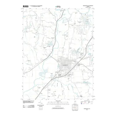
2010 Map of Martinsville
USGS Topo · Published 2010About this map
The White River carves a winding path through this portion of Morgan County, defining the geography of Martinsville and its surrounding communities. The landscape is characterized by a series of prominent ridges and peaks, such as Slaughterhouse Hill, Pumpkinvine Hill, and Jakes Butte, which overlook the river valley. In the northern reaches, the terrain becomes increasingly complex around Fox Cliff and Blue Bluff, where residential developments like Woodcrest and Shelburne have integrated into the hilly woodlands east of White Lick Creek.
Find a feature on this map
102 named features on this map. Tap any name to fly to it.
Don’t see what you’re looking for? This feature index may not catch every label — zoom into the map to look around manually.
Map Details
Editions of this 2010 Martinsville Map
This is the sole edition of this map. No revisions or reprints were ever made.
Other maps of this area

1942 · Franklin
USGS Topo · 1:125,000

1948 · Hindustan
USGS Topo · 1:24,000

1948 · Morgantown
USGS Topo · 1:24,000

1950 · Morgantown
USGS Topo · 1:24,000

1953 · Indianapolis
USGS Topo · 1:250,000

1955 · Hall
USGS Topo · 1:24,000

1955 · Cope
USGS Topo · 1:24,000

1955 · Mooresville West
USGS Topo · 1:24,000

1955 · Martinsville
USGS Topo · 1:24,000

1955 · Mooresville East
USGS Topo · 1:24,000