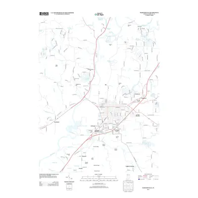
2013 Map of Martinsville
USGS Topo · Published 2013About this map
The White River winds through the heart of Morgan County, shaping a landscape of low hills and named hollows just outside Martinsville. The 2013 topography reveals a network of suburban expansion and industrial infrastructure, including Mc Daniel's Field Airport and the Clear Creek Fisheries. Several residential pockets such as Shelburne and Woodcrest appear alongside established rural settlements like Hyndsdale and Maxwell.
Find a feature on this map
217 named features on this map. Tap any name to fly to it.
Don’t see what you’re looking for? This feature index may not catch every label — zoom into the map to look around manually.
Map Details
Editions of this 2013 Martinsville Map
This is the sole edition of this map. No revisions or reprints were ever made.
Other maps of this area

1942 · Franklin
USGS Topo · 1:125,000

1948 · Hindustan
USGS Topo · 1:24,000

1948 · Morgantown
USGS Topo · 1:24,000

1950 · Morgantown
USGS Topo · 1:24,000

1953 · Indianapolis
USGS Topo · 1:250,000

1955 · Hall
USGS Topo · 1:24,000

1955 · Cope
USGS Topo · 1:24,000

1955 · Mooresville West
USGS Topo · 1:24,000

1955 · Martinsville
USGS Topo · 1:24,000

1955 · Mooresville East
USGS Topo · 1:24,000