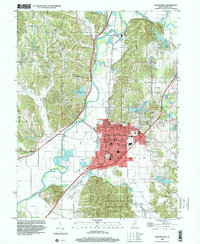
1998 Map of Martinsville
USGS Topo · Published 2001About this map
The county seat of Martinsville dominates the central landscape of this 1990s survey, showing its dense grid of streets like W Morgan St and Randolph St surrounding the central Courthouse and Post Office. The city is hemmed in by the broad valley of the White River to the west and the rising, dissected uplands of the Morgan Monroe State Forest to the south. This transition from the flat agricultural bottomlands, home to Champlin Meadows and McDaniels Field, to the wooded ridges like Peal Ridge and Bald Hill Ridge, illustrates the varied geography of central Indiana.
Find a feature on this map
74 named features on this map. Tap any name to fly to it.
Don’t see what you’re looking for? This feature index may not catch every label — zoom into the map to look around manually.
Map Details
Editions of this 1998 Martinsville Map
This is the sole edition of this map. No revisions or reprints were ever made.
Other maps of this area

1942 · Franklin
USGS Topo · 1:125,000

1948 · Hindustan
USGS Topo · 1:24,000

1948 · Morgantown
USGS Topo · 1:24,000

1950 · Morgantown
USGS Topo · 1:24,000

1953 · Indianapolis
USGS Topo · 1:250,000

1955 · Hall
USGS Topo · 1:24,000

1955 · Cope
USGS Topo · 1:24,000

1955 · Mooresville West
USGS Topo · 1:24,000

1955 · Martinsville
USGS Topo · 1:24,000

1955 · Mooresville East
USGS Topo · 1:24,000