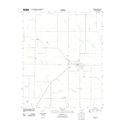
2011 Map of Marvell
USGS Topo · Published 2011About this map
The town of Marvell serves as the central hub of this agricultural landscape in Phillips County, Arkansas. The terrain is defined by a dense network of drainage channels and irrigation systems, including Coffee Creek, Crooked Creek, and the engineered Lateral Number 2, which support the surrounding field operations. The map provides a detailed view of the rural infrastructure at the start of the 2010s, showing the concentrated grid of Marvell alongside the smaller outlying communities of Hicksville and Hicks. Genealogists and local historians will find significant value in the distribution of family and community burial grounds, such as Schaffhauser Cemetery, Mount Mariah Cemetery, and Pastel Cemetery, which are scattered throughout the lowland farm tracts. This survey illustrates how the local road network, including numerous Phillips Road and County Road designations, has evolved to connect these isolated settlements and cemeteries across the creek-fed plains.
Find a feature on this map
56 named features on this map. Tap any name to fly to it.
Don’t see what you’re looking for? This feature index may not catch every label — zoom into the map to look around manually.
Map Details
Editions of this 2011 Marvell Map
This is the sole edition of this map. No revisions or reprints were ever made.
Other maps of this area

1939 · Modoc
USGS Topo · 1:62,500

1939 · Indian Bay
USGS Topo · 1:62,500

1940 · Marvell
USGS Topo · 1:62,500

1940 · Holly Grove
USGS Topo · 1:62,500

1948 · Helena
USGS Topo · 1:250,000

1948 · Modoc
USGS Topo · 1:62,500

1950 · Helena
USGS Topo · 1:250,000

1954 · Indian Bay
USGS Topo · 1:62,500

1955 · Helena
USGS Topo · 1:250,000

1956 · Marvell
USGS Topo · 1:62,500