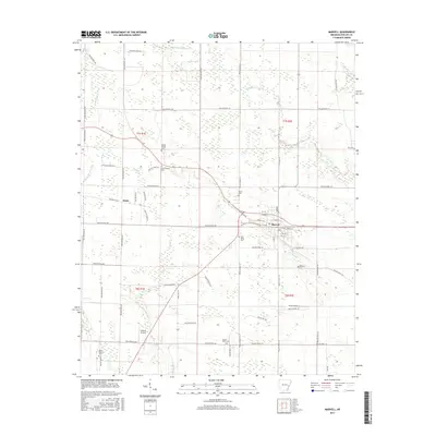
2017 Map of Marvell
USGS Topo · Published 2017About this map
The agricultural landscape of Phillips County is defined by its drainage network and small-town grid in this 2017 survey. Marvell serves as the primary hub, where the intersection of Hickory Ridge Rd and Old Hwy 1 meets the local street plan including Carruth Ave and College. The surrounding acreage is heavily managed by water control features like Lateral Number 2 and natural waterways such as Little Cypress Creek, Crooked Cr, and Coffee Cr. These streams navigate a low-lying terrain often prone to saturation, as evidenced by the presence of Cypress Swamp. Numerous small burial grounds are scattered across the township lines, including Mount Mariah Cem, Schaffhauser Cem, and Lone Valley Cem, providing a detailed record of local family history and rural community placement. Aviation interest is noted at Gibbons Airport, situated south of the small settlement of Hicks.
Find a feature on this map
74 named features on this map. Tap any name to fly to it.
Don’t see what you’re looking for? This feature index may not catch every label — zoom into the map to look around manually.
Map Details
Editions of this 2017 Marvell Map
This is the sole edition of this map. No revisions or reprints were ever made.
Other maps of this area

1939 · Modoc
USGS Topo · 1:62,500

1939 · Indian Bay
USGS Topo · 1:62,500

1940 · Marvell
USGS Topo · 1:62,500

1940 · Holly Grove
USGS Topo · 1:62,500

1948 · Helena
USGS Topo · 1:250,000

1948 · Modoc
USGS Topo · 1:62,500

1950 · Helena
USGS Topo · 1:250,000

1954 · Indian Bay
USGS Topo · 1:62,500

1955 · Helena
USGS Topo · 1:250,000

1956 · Marvell
USGS Topo · 1:62,500