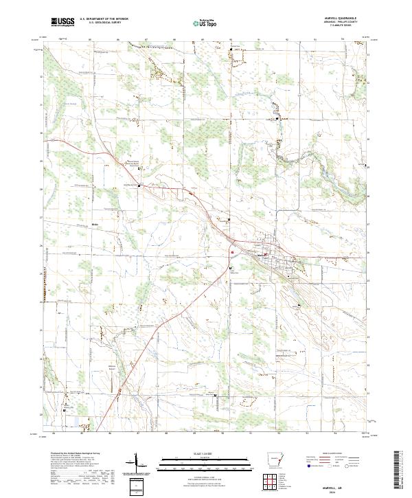
2024 Map of Marvell
USGS Topo · Published 2024About this map
The town of Marvell serves as the central hub of this agricultural landscape in Phillips County, defined by a dense network of county roads and drainage systems. The surrounding countryside is dotted with numerous small burial grounds and family-named landmarks that offer significant value for genealogical research, including the Mount Mariah Missionary Baptist Church-Cem and Schaffhauser Cem. The terrain transitions from the low-lying Cypress Swamp and Little Cypress Creek in the west toward more established farm plots in the east. Notable infrastructure includes the Gibbons Airport and the distinct alignment of State Hwy 318, which cuts through the southern reaches of the quadrangle. The map captures a contemporary look at the rural Delta, where water management features like Lateral Number 2 and Crooked Creek dictate the layout of the local road system.
Find a feature on this map
76 named features on this map. Tap any name to fly to it.
Don’t see what you’re looking for? This feature index may not catch every label — zoom into the map to look around manually.
Map Details
Editions of this 2024 Marvell Map
This is the sole edition of this map. No revisions or reprints were ever made.
Other maps of this area

1939 · Modoc
USGS Topo · 1:62,500

1939 · Indian Bay
USGS Topo · 1:62,500

1940 · Marvell
USGS Topo · 1:62,500

1940 · Holly Grove
USGS Topo · 1:62,500

1948 · Helena
USGS Topo · 1:250,000

1948 · Modoc
USGS Topo · 1:62,500

1950 · Helena
USGS Topo · 1:250,000

1954 · Indian Bay
USGS Topo · 1:62,500

1955 · Helena
USGS Topo · 1:250,000

1956 · Marvell
USGS Topo · 1:62,500